
2024 in Review: NASA Harvest’s Impact in Ukraine
As we step into 2025, Oleksandra Oliinyk, Ukraine Strategic Partnerships Manager at NASA Harvest, reflects on the accomplishments achieved in Ukraine during 2024 and shares insights into 2025.
Oleksandra, can you highlight NASA Harvest's accomplishments in Ukraine throughout 2024?
A two-day workshop in 2024, moderated by Oleksandra Oliinyk, brought together the NASA Harvest team and IMC, a Ukrainian agricultural holding, to enhance Ukraine's crop production estimates by utilizing IMC's on-ground expertise and farming data.
Let’s begin by revisiting the purpose of our work. Back in 2022, shortly after Russia’s full-scale invasion of Ukraine, the Ministry of Agrarian Policy and Food of Ukraine reached out to NASA Harvest for help. They needed assistance in assessing the war’s impact on agricultural production in both government-controlled and occupied territories. During wartime, when farmers are not obligated to report their plantings, satellite data becomes the most viable approach for understanding agricultural production and food availability. So the NASA Harvest team voluntarily took on the challenge to fill this critical information gap.
Unfortunately, the war continues, so we continue to assist the Ukrainian Ministry by providing agricultural estimates, including the area, yield, and production of main crops. This task remains the top priority for NASA Harvest's work in 2024, especially given impacts on global trade and food prices in the US.
As of the end of 2024, we provided estimates for temporarily occupied territories of Ukraine, where no national statistics or agricultural data are otherwise available. By cross-checking our remote-sensing estimates with Ukraine’s official statistics from government-controlled territories (Free Ukraine), we are confident in the accuracy of our estimates for the occupied territories.
What do you consider to be the most significant achievements for NASA Harvest in 2024 working on Ukraine?
Honestly, I would say our most significant achievement in 2024 has been the pilot project we launched with the Statistical Service of Ukraine, specifically their Department of Agriculture and Environment Statistics. It’s been such a rewarding experience because this project is all about integrating remote sensing technologies into the government’s current methodology for estimating key crop statistics. We are also able to take these lessons learned back to the US and other countries around the world in order to implement more efficient and cost-effective workflows.
What’s exciting about this collaboration is that we’re not just delivering data—we’re working together with the Ukrainian government to actually shape the way these estimates are created in the future. Our goal is to help build an independent, sustainable system that the government can fully implement and operate on their own.
For us, being trusted to contribute to such a big transformation in how agricultural data is managed in Ukraine and beyond is truly an honor. It feels like we’re helping to lay the groundwork for something that will have a lasting impact long after the current challenges are behind us.

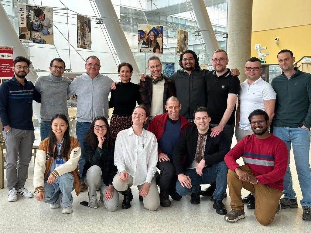
NASA Harvest, FAO, and the State Statistics Service (SSSU) of Ukraine held a three-day gathering to launch a pilot project in collaboration with the SSSU. In the photo, Taras Vysotskyi, the First Deputy Minister of Agrarian Policy and Food of Ukraine, delivers a speech highlighting the project's significance.
So, to summarize 2024—NASA Harvest has been consistently estimating Ukraine’s agricultural production and its impacts on the rest of the world since the onset of the full-scale war, which in the last year has led to the project with Service of Statistics of Ukraine and potential shift in the Ukraine government’s future crop estimation methodology by incorporating remote sensing technology in it.
Was there anything else notable from 2024 that you’d like to highlight?
Of course, crop production is just the core of our work. Last year, we conducted a major analysis on the impact of the Kakhovka Dam collapse. Sheila Baber led this research following NASA Harvest’s initial rapid response to the catastrophe, which occurred in 2023. The collapse left the region without water and power, flooded nearby cities and villages, and cut off water access to all the irrigation channels. In terms of its impact on agriculture, 2024 is when we saw the full effects of the dam collapse, as the 2023 season was partially irrigated, whereas the 2024 season began with dry irrigation canals. A notable observation is the switch in crop types planted in response to the loss in irrigation. This has major global implications given that the Black Sea region produces around a third of the world’s grain supply.
On top of this, we continued our project of monitoring artillery and rocket shelling across the front lines, using very high resolution imagery and machine learning. This project aims to benefit demining efforts in the early stages of prioritization of hazard areas, and similar methodologies could be used in other conflict-affected regions.
What are the main challenges you have faced in 2024 while working on Ukraine?
One of the biggest hurdles in 2024 was overcoming stereotypes and misconceptions about remote sensing, often influenced by profit-driven satellite imagery interpretation service providers in Ukraine. I would say that almost all our Ukrainian stakeholders, both private and public, had misconceptions about how the technology works, its accuracy, and its overall potential and limitations. I believe it's because public independent research wasn't strong enough in Ukraine, and methodologies used by private companies would have enormous errors on a country scale, but was the only source of information about the technology. We’ve put a lot of effort into challenging these outdated views in Ukraine's agricultural sector and fostering a better understanding of satellite data applications.
As Dr. Inbal Becker Reshef, NASA Harvest's program director, often says, remote sensing shouldn’t replace traditional methods but should complement them.
Together, they create a stronger, more reliable framework for producing agricultural analytics. Yes, satellite data is a game-changer—it provides real-time imagery that enables quick and accurate assessments of yields, land use, and crop health. With earth observation, we can monitor crops throughout the season and update production estimates in near real-time. However, interpreting satellite data requires expertise and a significant shift in an organization’s resource priorities. And while higher-resolution data can help, it is expensive and not always accessible. Balancing these factors is essential to making remote sensing work effectively.
Personally, for me, the main challenge and most significant achievement was establishing a partnership with Nibulon LLC. We needed data from the fields in southern Ukraine to verify and calibrate our recognition models effectively. Since the start of the full-scale war, we have maintained partnerships with agroholdings and farmers across Ukraine, providing us with data from various regions. However, obtaining data from the south of Ukraine was particularly challenging due to the region's agricultural history and the ongoing war. All my efforts were focused on closing this gap, and finally, in 2024, we succeeded in partnering with Nibulon LLC. I am incredibly grateful for this opportunity and for the trust Nibulon has placed in us, especially given the horrifying challenges the company faces, being so close to the front line during the war.
From a global perspective, why does work on Ukraine need to continue this year and in the future?
Ukraine is often referred to as Europe’s breadbasket, critical not only for global food security and food price stability, but also for humanitarian food supply. As Ukraine remains one of the world’s top 10 agricultural producers and exporters, continuous monitoring of food production in the region has always been critical in a food security and market stability context. This is especially true in light of the ongoing war-driven disruptions to farm management and agricultural supply chain logistics, the effects of which are felt not only locally but globally.
Earth observation data can help improve market transparency by quantifying production ahead of harvest. This information is vitally important for informing markets – where any surprise reductions in Ukraine’s wheat supply can ultimately impact food price increases – as well as for global food security given that Ukraine supplies agricultural products to many food-insecure regions of the world.
How do you see the future of this work evolving in 2025 and beyond?
I hope to see the public sector develop its own in-house methodologies for satellite-based observations over time, ultimately reducing the need for NASA Harvest's involvement. This would make remote sensing technology more robust, cost-effective, and sustainable, enabling its application across other projects and needs in Ukraine, the US, and beyond. We are committed to supporting this journey toward advancing knowledge and technology in this field.